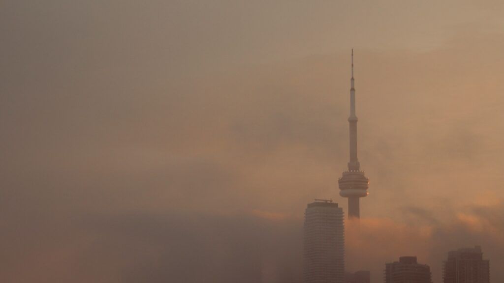
Toronto greets September with heavy fog, rising humidity and storm risk
The city woke up to near-zero visibility conditions Tuesday as Environment Canada issued a fog advisory, with muggy weather and thunderstorm risks expected to persist through the week. The humidity-dominated weather pattern follows weekend rainfall and aligns with seasonal forecasts predicting an unsettled start to fall.
Toronto residents began September under a thick blanket of fog Tuesday morning, marking the start of a humid and potentially stormy stretch of weather that promises to linger through the week. Environment Canada issued a yellow-level fog advisory for the city and surrounding regions, warning drivers of hazardous near-zero visibility conditions during the crucial morning commute period when traffic volumes peak across the Greater Toronto Area.
Fog advisory creates hazardous commuting conditions
The weather agency's advisory specifically covered Toronto along with Pickering, Oshawa, Southern Durham and Vaughan, Richmond Hill, Markham areas before being lifted later in the morning as visibility gradually improved. The dense mist that blanketed much of the region created particularly challenging driving conditions before sunrise, when visibility dropped to near-zero in localized pockets. Environment Canada emphasized the importance of defensive driving measures, repeatedly reminding motorists to reduce speeds and use headlights to improve both visibility and conspicuity.
Transition to humid, storm-prone weather pattern
With the morning fog dissipated, Toronto transitioned into a day characterized by mixed clouds, intermittent sunny breaks, and scattered showers with the potential for thunderstorms developing throughout the afternoon and evening hours. The official high temperature reached 28°C, though the humidex, which factors in both heat and humidity, made it feel like a sweltering 36°C. Overnight conditions offered minimal relief with partly cloudy skies, continued thunderstorm potential, and a warm low of 20°C that maintained the oppressive humidity levels.
Extended forecast shows persistent mugginess
Wednesday's forecast suggests a continuation of this uncomfortable weather regime, with showers, thunderstorms, and another high of 28°C expected across the region. The humidex could reach an even more uncomfortable 37°C before temperatures dip slightly to 18°C overnight, still offering little meaningful relief from the persistent humidity. Thursday maintains mostly cloudy skies with ongoing shower and thunderstorm chances, though temperatures may moderate slightly to a high of 26°C. The first substantive break from this unsettled pattern appears to arrive Friday with a mix of sun and cloud and more seasonal highs near 26°C.
Humidity dominates late-summer weather systems
The current weather system exemplifies Toronto's typical late-summer atmospheric patterns where tropical moisture gets funneled northward, creating extended periods of high humidity and instability. The consecutive days with humidex values in the mid-to-high 30s demonstrate how moisture-laden air masses can make temperatures feel significantly hotter than thermometer readings suggest. These conditions frequently trigger scattered, sometimes intense thunderstorms as the atmosphere attempts to release the built-up thermal energy and moisture content.
Precipitation follows weekend rainfall events
The fog and thunderstorm risks arrive on the heels of substantial rainfall that soaked Toronto streets to start the work week, forcing commuters to utilize umbrellas and rain gear during their Monday morning travels. The precipitation pattern began establishing itself on Sunday when rain showers started in late morning and continued through the afternoon, helping to saturate the ground and load the lower atmosphere with moisture, key ingredients for both the morning fog development and subsequent thunderstorm potential.
Broader weather context and climate patterns
This stretch of humid, unsettled weather aligns with Environment Canada's seasonal outlook predicting above-average rainfall for southern Ontario this fall. The persistence of high humidity values reflects broader climate patterns where warmer global temperatures allow the atmosphere to retain more water vapor. These conditions have become increasingly common during Toronto's late summer period, often extending into early fall before cooler, drier air masses establish more permanent residence.
Impacts on public health and infrastructure
The combination of reduced visibility from fog and heavy rainfall creates multiple transportation hazards, from impaired driver visibility to hydroplaning risks on wet roadways. The high humidex values pose particular health concerns for vulnerable populations including the elderly, young children, and those with pre-existing respiratory conditions. Outdoor events and construction schedules must account for sudden downpours and lightning risks, while the muggy overnight conditions reduce opportunities for natural cooling in homes without air conditioning.
Seasonal transition outlook
While the current weather pattern reflects late summer's typical humidity, historical data suggests Toronto should gradually transition toward more stable fall conditions in the coming weeks. The persistence of these muggy air masses into early September isn't unusual, though climate trends indicate such periods may be lasting longer and occurring more frequently. Residents can expect these conditions to gradually give way to cooler, drier air as the sun's angle decreases and prevailing wind patterns shift toward more northerly directions later in the month.
Other regional weather developments
The weather system affecting Toronto coincides with several other meteorological events across the region. Heavy rain soaked the city streets to start the work week, prompting commuters to take out their umbrellas for the morning commute. Rain showers that began late Sunday morning and continued into the afternoon ushered in this current unsettled week of humid weather across the Greater Toronto Area.
Related local events and issues
The weather conditions come as Toronto prepares for its annual Caribbean Carnival, where festivalgoers will need to contend with the humid conditions while celebrating in the streets. Last week saw hundreds of cyclists rally downtown to protest the removal of bike lanes, arguing the changes will make Toronto streets more dangerous regardless of weather conditions.
In unrelated local news, Toronto police investigators are alleging that suspects in an apparent roofing scam posed as roofing fraud inspectors in an attempt to dupe a homeowner into paying for unnecessary repairs. Meanwhile, Canadian families continue waiting for answers on loved ones missing following flash flooding in Nepal.