James Cook
Captain James Cook (1728 to 1779) was a British Royal Navy officer, explorer, and cartographer whose three Pacific voyages between 1768 and 1779 fundamentally reshaped European understanding of the world. His work is of particular significance to Canada for his early hydrographic surveys in Atlantic Canada and the St. Lawrence River, which were crucial for the British military campaign during the Seven Years' War. Cook's precise charting of the Newfoundland coast and his role in the Siege of Quebec established foundational geographic knowledge for future Canadian development. His later explorations, which included the first recorded European contact with the eastern coast of Australia and the Hawaiian Islands, cemented his legacy as one of history's greatest navigators.
Early Life and Merchant Navy Career
James Cook was born on 7 November 1728 in the village of Marton in Yorkshire. He was the second of eight children born to James Cook, a Scottish farm labourer, and Grace Pace. In 1736, the family moved to Great Ayton, where his father's employer paid for him to attend the local school. After five years of formal education, he began working for his father on the farm. At age 16 in 1745, Cook moved to the fishing village of Staithes to begin an apprenticeship as a shopboy for grocer William Sanderson. The Walkers took Cook on as a merchant navy apprentice in their fleet of colliers, ships that carried coal along the English coast. His first assignment was aboard the collier Freelove, and he spent several years learning the coastal trade between the Tyne and London. During his apprenticeship, Cook diligently studied algebra, geometry, trigonometry, navigation, and astronomy, essential skills for commanding a vessel. He obtained his mariner's licence in 1752 and was promoted to mate aboard the collier brig Friendship, where he served for two and a half years, gaining extensive experience in the shallow and difficult waters around the British Isles, including the Irish Sea and the English Channel.
Royal Navy Service and Work in North America
In 1755, with Britain preparing for the Seven Years' War, the 26-year-old Cook was offered command of the Friendship but declined, choosing instead to join the Royal Navy. He entered as an able seaman aboard HMS Eagle, where he saw early action capturing a French warship. Cook quickly advanced, becoming the ship's boatswain and briefly commanding the cutter Cruizer. He passed his master's examinations at Trinity House in June 1757, qualifying him to handle a ship of the King's fleet. His first posting as ship's master was aboard the frigate HMS Solebay. Cook's service during the war was primarily in North American waters, where his talents for surveying and hydrography came to the fore and laid the groundwork for his future explorations. During the Siege of Louisbourg in 1758, Cook served as master aboard HMS Pembroke and took part in the major amphibious assault that captured the fortress from the French.
After the fortress fell, he met army surveyor Samuel Holland, who taught him advanced plane-table surveying techniques. This partnership combined Holland's land-surveying skills with Cook's hydrographic knowledge. Their collaboration produced preliminary charts of the entrance to the St. Lawrence River, with Cook writing the accompanying sailing directions. Cook's first published map was of Gaspé Bay, drawn in 1758 and engraved in 1759. In 1759, his work was critical to General James Wolfe's campaign against Quebec. Cook and other masters took soundings and marked shoals in the river, enabling Wolfe's troops to cross stealthily at night, leading to the British victory at the Battle of the Plains of Abraham. After the war, Cook was tasked with charting the coast of Newfoundland.
Appointed master of HMS Grenville, he spent five surveying seasons from 1763 to 1767 meticulously mapping its rugged shores. His work proceeded in stages, covering the north-west coast, the south coast, and finally the west coast. Cook employed local pilots to identify hidden dangers. The work was hazardous. In August 1764, a powder horn exploded, severely injuring his right hand, and in July 1765, Grenville ran aground on an uncharted rock. While in Newfoundland in 1766, Cook made precise astronomical observations of a solar eclipse. He sent his data to astronomer John Bevis, who used it to calculate longitude, a result later published by the Royal Society and incorporated into Cook's sailing directions for Newfoundland.
The First Voyage (1768 to 1771)
Cook's demonstrated skill in hydrography and astronomy led the Admiralty and the Royal Society to select him to command a scientific expedition to the Pacific. The public goal was to observe the 1769 transit of Venus from Tahiti, while secret orders directed him to search for the postulated southern continent, Terra Australis Incognita. In May 1768, the 39-year-old Cook was promoted to lieutenant and given command of HMS Endeavour, a sturdy Whitby collier chosen for its shallow draught and strong construction. The expedition departed England on 25 August 1768. After a stop in Tierra del Fuego, where two of Banks' servants died from exposure, Endeavour reached Tahiti in April 1769. The transit of Venus was successfully observed in June, and Cook also became one of the first Europeans to witness surfing.
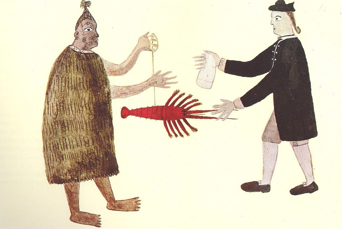
Following the astronomical observations, Cook opened his sealed orders and began the search for the southern continent. He sailed to New Zealand, making first European contact with the Māori in October 1769 at Poverty Bay. Initial encounters were violent, but with the aid of Tahitian priest Tupaia, communication was established. Cook meticulously circumnavigated and charted both main islands of New Zealand, proving they were not part of a larger continent. He then sailed west, and on 19 April 1770, his crew sighted the east coast of Australia. Cook charted the coastline northward, making his first landfall at Botany Bay on 29 April. After a brief and tense encounter with the Gweagal people, the expedition continued north, narrowly avoiding disaster when Endeavour ran aground on the Great Barrier Reef on 11 June. The ship was repaired over seven weeks at the Endeavour River, where Cook first documented the kangaroo.
Continuing to the northern tip of Australia, Cook claimed the entire eastern coast he had surveyed for Britain on Possession Island. The expedition then sailed through the Torres Strait and stopped for critical repairs in Batavia (modern Jakarta). The stay in the disease-ridden port proved devastating. Seven crew died there and 23 more perished on the journey home from dysentery and malaria. Endeavour finally returned to England on 12 July 1771. Cook was promoted to commander, and the voyage's accounts, published in 1773, brought him great acclaim. The voyage had achieved its scientific goals, charted New Zealand and Australia's east coast, and disproved the existence of a habitable southern continent in the mid-Pacific.
The Second Voyage (1772 to 1775) and Later Career
Eager to settle the question of Terra Australis definitively, the Admiralty commissioned Cook for a second voyage in 1772. This time he commanded two ships, HMS Resolution and HMS Adventure. The expedition became the first to cross the Antarctic Circle in January 1773 and conducted a vast criss-crossing exploration of the South Pacific. Cook's ships spent three years traversing the ocean, visiting Easter Island, the Marquesas, Tahiti, the Tongan islands, and the New Hebrides (Vanuatu). They also revisited New Zealand. The voyage conclusively proved that any great southern landmass, if it existed, lay in inhospitable frozen latitudes and was not the fertile continent Europeans had imagined. Cook's innovative use of a copy of John Harrison's marine chronometer (K1) and his rigorous anti-scorbutic diet, which included sauerkraut and malt wort, kept his crew remarkably healthy.
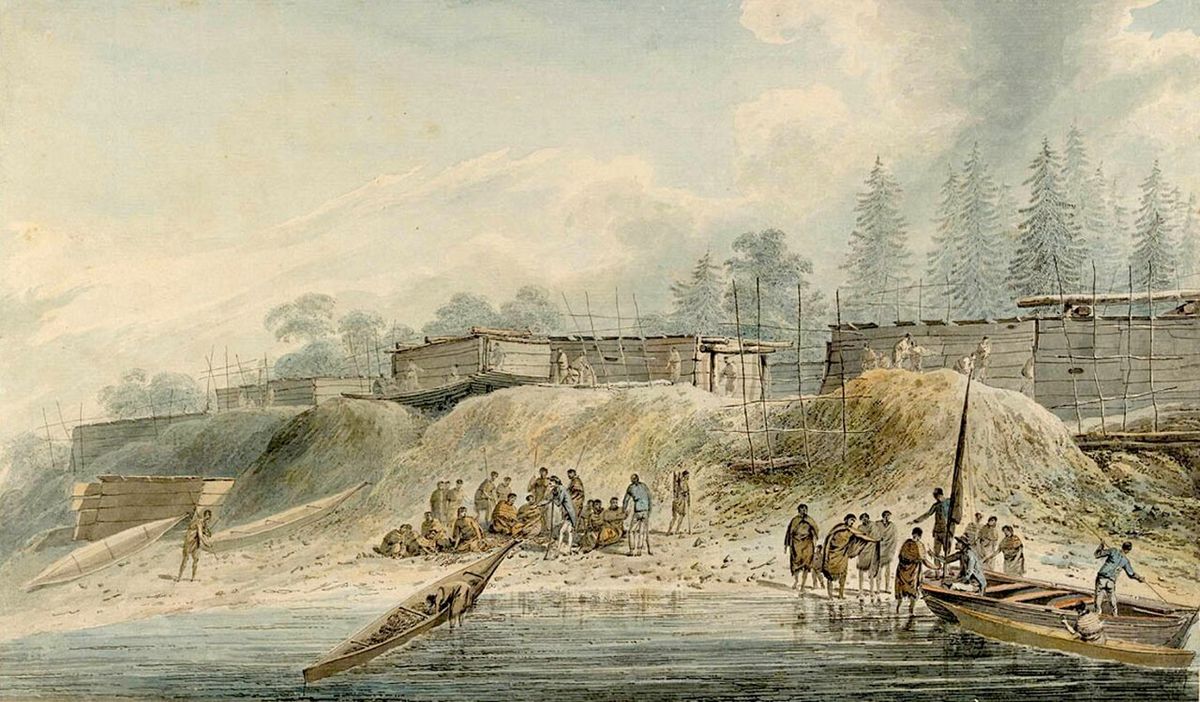
Upon his return in 1775, Cook was promoted to post-captain and elected a Fellow of the Royal Society. He settled briefly in London, but the search for another geographic prize, the Northwest Passage, soon called him back to sea. The publicly stated mission was to return a Tahitian man, Omai, to his homeland, but the secret objective was to search for a Pacific entrance to the Northwest Passage. They then proceeded to the North American coast, mapping from present-day Oregon northward through the Bering Strait until stopped by impenetrable ice.
Death in Hawaii and Legacy
Initially received as a deity associated with Lono, a harvest god, relations deteriorated over time. On 14 February 1779, a dispute over a stolen cutter escalated into a violent confrontation on the beach at Kealakekua Bay. In the ensuing chaos, Cook was struck from behind and then stabbed, dying in the shallow water. His death sent shockwaves through Europe. Cook's body was treated with traditional Hawaiian rites for high-ranking individuals. Some of his remains were later returned to his crew for burial at sea.
James Cook's legacy is extensive and complex. He was a master navigator and cartographer whose charts of the Pacific were so accurate they were used for over a century. His voyages filled vast blank spaces on the European map, from the coasts of Canada and Alaska to New Zealand, Australia, and numerous Pacific islands. His emphasis on crew health through diet changed long-distance sea travel. For Canada, his early surveys of the St. Lawrence River and the Newfoundland coast were of immediate strategic and economic importance, facilitating settlement. While his encounters with Indigenous peoples were often marked by cultural misunderstanding and violence, his detailed journals provide invaluable early ethnographic records. Memorials to Cook exist worldwide, from the obelisk at his childhood home in Great Ayton to the large monument overlooking Kealakekua Bay in Hawaii.
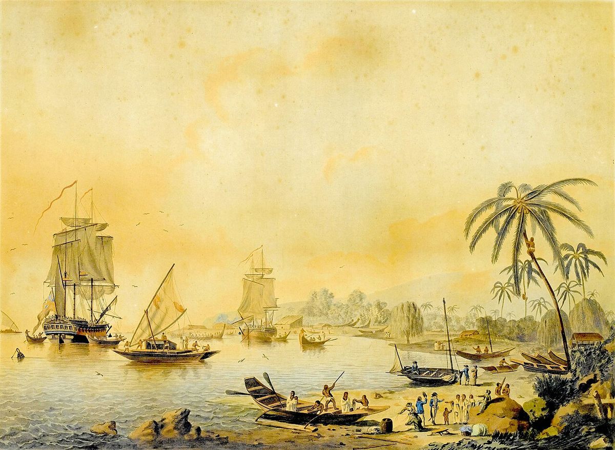
Ships Under Cook's Command
Throughout his career, James Cook commanded several vessels, each chosen for specific qualities suited to exploration. His commands reflect his preference for sturdy, practical ships capable of handling unknown and hazardous waters. Cook's choice of colliers, or 'Whitby cats,' was deliberate. Their flat bottoms allowed them to sit upright if grounded, their shallow draught permitted coastal exploration, and their large hold capacity allowed for extended voyages. He credited the qualities of Endeavour with saving his expedition during the grounding on the Great Barrier Reef.
- HMS Endeavour (1768 to 1771): A former Whitby collier originally named Earl of Pembroke, chosen for its shallow draught and strong hull. It carried Cook on his first Pacific voyage.
- HMS Adventure (1772 to 1775): Commanded by Tobias Furneaux, this consort ship accompanied Resolution on Cook's second voyage.
- HMS Grenville (1763 to 1767): A schooner used by Cook during his five seasons of surveying the coast of Newfoundland.
- HM Cutter Cruizer (1756): A small vessel attached to HMS Eagle, providing Cook with his first brief experience of command.
Key Locations Charted and Claimed
Captain James Cook's three voyages of exploration between 1768 and 1779 resulted in the detailed mapping of numerous territories across the globe. He made contact with numerous indigenous peoples and claimed several territories for the Kingdom of Great Britain. During these voyages, Cook sailed tens of thousands of miles across largely uncharted areas, mapping coastlines, islands, and features across the globe in greater detail than previously charted. His voyages left a legacy of scientific and geographical knowledge that influenced his successors well into the 20th century.
- Newfoundland Coast (1763 to 1767): Produced the first accurate, large-scale charts of the island's entire coastline.
- Society Islands (1769): Claimed Raiatea-Taha'a, Huahine, Borabora, Tupai, and Maupiti for Britain, naming the archipelago.
- New Zealand (1769 to 1770) Completed the first circumnavigation and detailed charting of the country's two main islands.
- Eastern Australia (1770): Charted the coastline from Point Hicks to Cape York, claiming it as British territory.
- Antarctic Circle (1773): Resolution and Adventure became the first ships to cross the Circle, exploring the Southern Ocean.
Questions about James Cook
What was James Cook's connection to Canada?
James Cook's early career was deeply connected to Canada. During the Seven Years' War, as master of HMS Pembroke, he participated in the siege of Louisbourg in Nova Scotia in 1758. More significantly, he surveyed and mapped the entrance to the St. Lawrence River, and his charts and soundings were instrumental in General James Wolfe's successful attack on Quebec in 1759. After the war, from 1763 to 1767, Cook was tasked with charting the entire coast of Newfoundland aboard HMS Grenville, producing highly accurate maps that were vital for navigation and fisheries.
What did James Cook discover on his first voyage?
On his first voyage aboard Endeavour (1768 to 1771), Cook completed the first recorded circumnavigation and detailed mapping of New Zealand's main islands, proving they were not attached to a larger continent. He then became the first European to chart the eastern coastline of Australia, making landfall at Botany Bay. The voyage also successfully observed the transit of Venus from Tahiti and explored several Pacific islands. While he did not discover a new continent in the South Pacific, he conclusively mapped New Zealand and Australia's east coast for Europe.
How did James Cook die?
James Cook was killed on 14 February 1779 at Kealakekua Bay on the island of Hawaii during his third voyage. A dispute arose after Hawaiians took a small cutter from one of his ships. In an attempt to take the Hawaiian king, Kalaniʻōpuʻu, hostage to force the return of the boat, tensions escalated into a violent confrontation on the beach. Cook was struck on the head and then stabbed by Hawaiian warriors. His body was subjected to traditional funerary rites, and some of his remains were later returned to his crew for a burial at sea in the bay.
What was James Cook's role in preventing scurvy?
Cook was a pioneer in preventing scurvy, a debilitating disease caused by vitamin C deficiency that plagued long sea voyages. He insisted on a strict diet for his crews that included foods known or believed to have anti-scorbutic properties. These included sauerkraut (fermented cabbage), portable soup (a dried vegetable broth), malt wort, and whenever possible, fresh greens, fruit, and fish. His methods were remarkably successful, especially on his second voyage, where he lost very few men to disease.
Did James Cook discover Hawaii?
James Cook was not the first European to sight the Hawaiian Islands, but his expedition made the first sustained and recorded contact with them. He named the archipelago the Sandwich Islands after his patron, the Earl of Sandwich. Cook and his crew spent several weeks there before continuing north. They returned to the islands a year later in 1779, which led to the events surrounding Cook's death at Kealakekua Bay on the main island of Hawaii.
What type of ships did Cook use for exploration?
Cook famously used sturdy, flat-bottomed merchant colliers, often called 'Whitby cats,' for his long voyages of exploration. For his first voyage, he commanded HMS Endeavour, a former coal carrier. For his second and third voyages, his flagship was HMS Resolution, another converted collier. He favoured these vessels because their shallow draught allowed them to sail close to shore and into unknown bays, their strong hulls could withstand grounding, and their large holds could carry ample supplies for years-long journeys. Cook credited the design of Endeavour with saving his expedition after it ran aground on the Great Barrier Reef.
Sources and further reading
- James Cook (Wikipedia)
- James Cook (literaryconsultancy.co.uk)
- MY WRITING LIVING: JAMES COOK (alcs.co.uk)
- James Cook, Audio Books, Best Sellers, Author Bio, Audible (audible.ca)
Checked by the Yadude Books desk. Last updated 2026-10-19.