Record-breaking 'super' El Niño could bring warmer, drier winter to western Canada, increased risks in Ontario
Meteorologists warn a strengthening El Niño climate pattern may lead to historic temperature anomalies and heightened wildfire risks across Canada this winter.
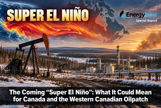
A developing 'super' El Niño climate pattern in the Pacific Ocean could bring significant weather impacts to Canada this winter and into 2027, with western regions facing particularly warm and dry conditions while Ontario contends with freezing rain and flooding risks, according to meteorological experts. The event's unprecedented strength could reshape seasonal weather patterns across the country, with some regions experiencing beneficial effects while others face heightened environmental risks.
Unprecedented El Niño strength
The current El Niño event is strengthening rapidly and could become the strongest on record, according to CityNews chief meteorologist Natasha Ramsahai. Based on National Oceanic and Atmospheric Administration (NOAA) forecasts, sea surface temperatures in the Pacific Ocean's equatorial zone are already approaching 2°C above average - the threshold for a 'super' El Niño designation. The speed of this development has challenged forecasting systems, with Ramsahai stating
"Since the spring, we've had such a rapid transition that the forecast models can't even keep up."Historical data shows the current record temperature anomaly stands at 2.4°C above average from the 1982-83 event, but some projections suggest this winter could reach 3-4°C anomalies, potentially setting new records for Pacific Ocean warming.
Western Canada faces greatest impacts
Western Canada and the Prairies will likely experience the most pronounced effects, with Ramsahai predicting "warm and dry conditions throughout winter" that could extend into spring and summer 2027. This pattern may result in significantly reduced snowpack, which carries multiple environmental consequences. Ramsahai explained these cascading effects:
"That means a reduction in snow melt, a reduction in insulation, and an increase in wildfire and drought risk."The meteorologist emphasized this will likely mean little to no snow packs in many affected areas, calling it
"the biggest impact that we're going to be talking about nationally when it comes to El Niño and the strength of El Niño this winter."These conditions could have serious implications for water management, agricultural planning, and wildfire preparedness throughout the region.
Eastern Canada's varied outlook
Quebec and most Maritime provinces might see cooler than average conditions this winter, representing a different set of challenges for those regions. Meanwhile, Southern Ontario faces a complex set of potential impacts from the El Niño pattern. Ramsahai noted an increased likelihood of freezing rain and flooding events, along with a shorter winter season that could compress the ski season. The Great Lakes might see an extended shipping season due to reduced ice buildup, but the region could also experience more potholes from increased freeze-thaw cycles. Agricultural sectors could face disruptions, with maple syrup and ice wine production potentially suffering if temperatures don't drop sufficiently. Ramsahai cautioned these projections could change given the volatile nature of weather patterns, emphasizing that regional impacts may vary significantly.
The science behind El Niño
El Niño is part of a natural climate cycle that alternates every two to seven years with its counterpart La Niña (cooler-than-normal conditions) and neutral phases. Ramsahai explained the atmospheric and oceanic mechanics driving these patterns:
"When those trade winds are strong, they blow the hottest of the water in the Pacific westward allowing cooler water to upwell from below near South America. When those winds relax, that hot water starts flooding back... and that hot water pool sits through the middle and eastern parts of the Pacific."The temperature difference from average determines the strength of each El Niño episode, and this year's event shows signs of being particularly intense. These ocean temperature anomalies influence atmospheric circulation patterns that can affect weather globally, sometimes overriding other climate influences. The phenomenon demonstrates how interconnected Earth's climate systems are, with Pacific Ocean temperatures affecting weather thousands of miles away.
Potential benefits amid challenges
One positive effect of the early El Niño development has been the absence of Atlantic hurricanes so far this season, sparing Atlantic Canada from potential storms. As of mid-September, no major hurricanes had formed in the Atlantic - an unusually late start to the hurricane season. Ramsahai provided historical context, noting that in 2002 and 2013, the first major hurricanes didn't begin until September 11, marking the latest starts since satellite tracking began in 1966. This hurricane suppression effect could continue if the El Niño maintains its strength through the remainder of the tropical storm season. The phenomenon illustrates how climate patterns can have both positive and negative regional impacts simultaneously.
Historical context and long-term outlook
The NOAA forecast suggests a greater-than-90% chance that this will be a "historic" El Niño event peaking this winter but potentially lasting through May 2027. The current sea surface temperature anomaly of 1.89-2°C above average as of August is already approaching the threshold for a 'super' El Niño classification. Historical records show these events typically last 9-12 months, but particularly strong episodes can influence weather patterns for longer periods. The strength of these events is measured by how much they deviate from normal Pacific Ocean temperatures in the affected zone. Ramsahai explained that while El Niño is a natural cycle, its effects occur against the backdrop of ongoing climate change, potentially amplifying some impacts. The current projections suggest this event could be among the strongest ever recorded, with significant implications for weather patterns across North America.
Preparing for climate variability
The potential for record-breaking temperature anomalies suggests we may be entering uncharted territory in terms of weather impacts. While some effects like reduced hurricane activity and extended shipping seasons may provide temporary benefits, the broader implications of reduced snowpack and increased wildfire risk could have lasting consequences for water resources, agriculture, and forest management. Municipalities may need to prepare for increased pothole damage from freeze-thaw cycles, while farmers might need to adapt crop plans for potentially early springs. This event serves as an important case study in how natural climate variability interacts with longer-term climate trends, potentially creating novel challenges for infrastructure, emergency preparedness, and resource management across Canada's diverse regions.
Monitoring and adaptation
As the El Niño continues developing, meteorologists will closely monitor sea surface temperatures and atmospheric patterns to refine forecasts. The event's progression could provide valuable insights into how extreme El Niño events behave under current climate conditions. Communities across Canada may need to consider adaptive measures, from wildfire prevention strategies in the west to flood preparedness in Ontario. The situation underscores the importance of understanding both short-term climate variability and long-term climate trends when planning for environmental and economic resilience.